JOIN THE CLUB. FIND MORE FISH.
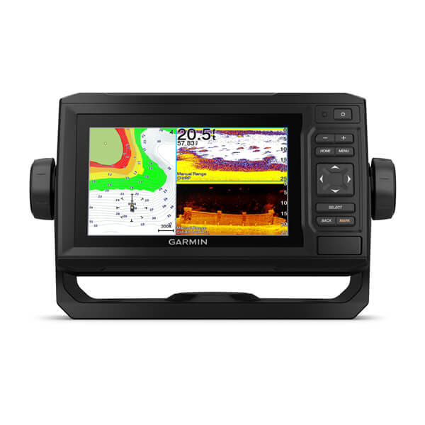
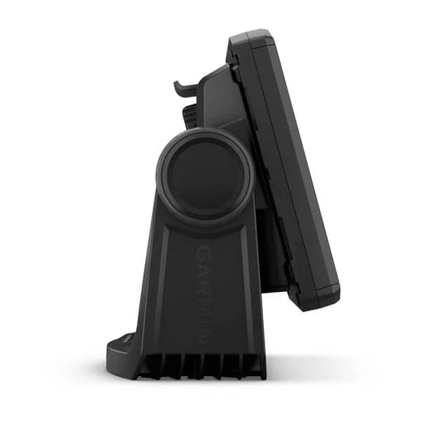
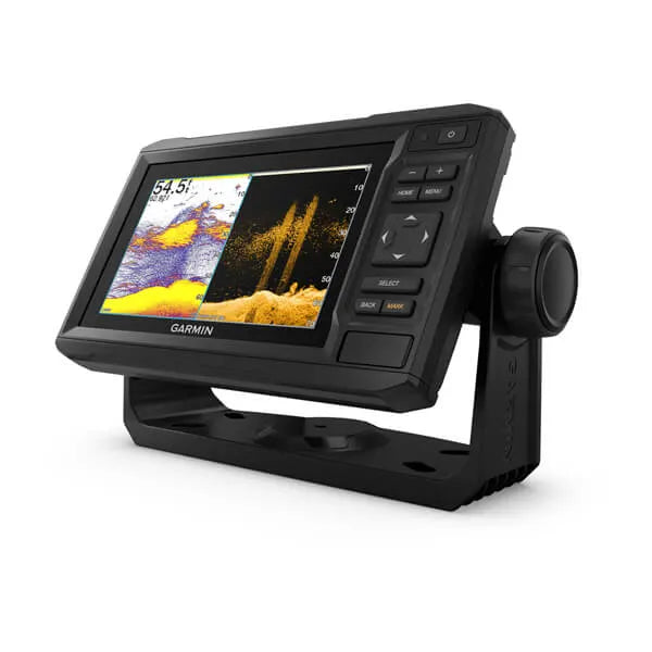
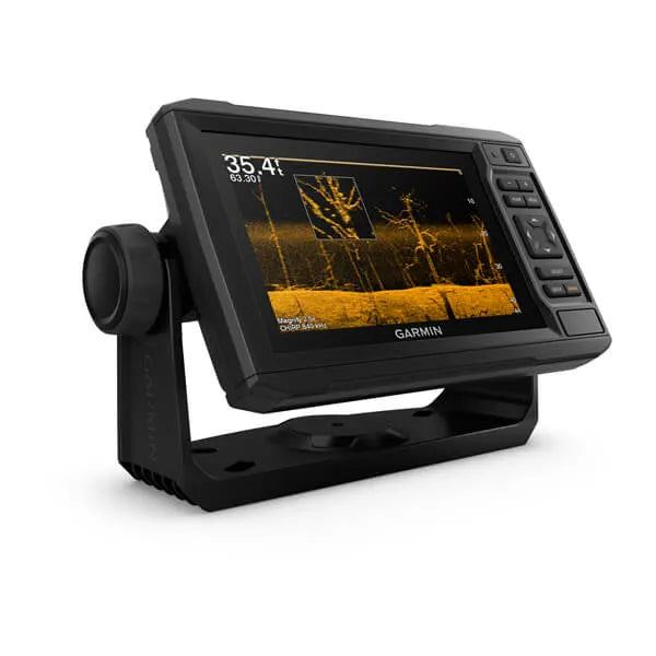
The sunlight-readable 6” chartplotter features a quick-release bail mount and a transducer for Ultra High-Definition scanning sonar and CHIRP traditional sonar.
See below your boat in incredible detail with included transducer
Navigate any waters with preloaded LakeVü g3 inland maps
Manage your marine experience from nearly anywhere
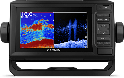
INCLUDED TRANSDUCER
This chartplotter comes with a GT24 transducer for Ultra High-Definition ClearVü scanning sonar, which shows you a crystal-clear image below your boat. Plus, you get Garmin high wide CHIRP traditional sonar for remarkable target separation.

NMEA 2000® AND NMEA 0183 NETWORKS
Connect to autopilots, digital switching, weather, FUSION-Link™ audio system, media, VHF, AIS and more from one screen.
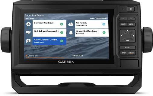
ACTIVECAPTAIN® APP
Built-in Wi-Fi® connectivity pairs with the free all-in-one mobile app for access to the OneChart™ feature, smart notifications1, software updates, Garmin Quickdraw™ Community data and more.
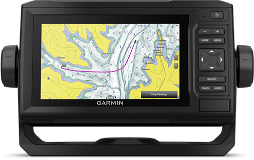
PRELOADED MAPPING
Experience unparalleled coverage and detail with preloaded LakeVü g3 inland maps featuring integrated Navionics® data that covers more than 17,000 lakes with up to 1’ contours.
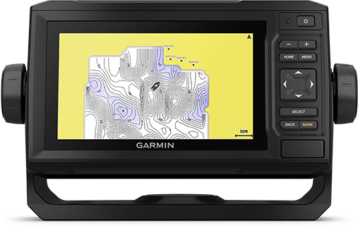
QUICKDRAW CONTOURS
Create personalized fishing maps on-screen with 1’ contours. Keep the data to yourself, or share it with the Quickdraw Community on Garmin Connect™.
Create your own maps on the fly and tailor them to fit your needs
General |
|
| DIMENSION | 8.6" x 5.1" x 2.6" (21.8 x 13.0 x 6.2 cm) |
|---|---|
| INPUT | Keyed |
| DISPLAY SIZE | 5.4" x 3.1"; 6.2" diagonal (13.7 x 7.7 cm; 15.2 cm diagonal) |
| DISPLAY RESOLUTION | 800 x 480 pixels |
| DISPLAY TYPE | WVGA, NP |
| WEIGHT |
1.6 lbs (0.7 kg) |
| WATERPROOF |
IPX7 |
| MOUNTING OPTIONS | Bail or flush |
Maps & Memory |
|
| ACCEPTS DATA CARDS |
1 microSD card; 32 GB maximum size |
|---|---|
| WAYPOINTS |
5000 |
| TRACK POINTS | 50,000 |
| TRACKS | 50 saved tracks |
| NAVIGATION ROUTES | 100 |
Sensors |
|
| HAS BUILT-IN RECEIVER | |
|---|---|
| RECEIVER |
5 Hz |
| NMEA 2000 COMPATIBLE | |
| NMEA 0183 COMPATIBLE | |
| GPS | |
| SUPPORTS WAAS | |
Built-in Maps |
|
| LAKEVU (INLAND) | |
|---|---|
| (SOUNDER) TIDE TABLES | |
Optional Map Support |
|
| BLUECHART G3 | |
|---|---|
| BLUECHART G3 VISION | |
| LAKEVÜ G3 | |
| LAKEVÜ G3 ULTRA | |
| (SOUNDER) TOPO | |
| STANDARD MAPPING | |
| GARMIN QUICKDRAW CONTOURS | |
Chartplotter Features |
|
| AIS | |
|---|---|
| DSC | |
| SUPPORTS FUSION-LINK™ COMPATIBLE RADIOS | |
| ACTIVECAPTAIN® COMPATIBLE |
yes |
| WIRELESS REMOTE COMPATIBLE | |
| SAILING FEATURES | |
Sonar Features & Specifications |
|
| DISPLAYS SONAR | |
|---|---|
| POWER OUTPUT | 500 W |
| TRADITIONAL SONAR (DUAL FREQUENCY/BEAM) | built-in (single channel CHIRP, 70/83/200 kHz, L, M, H CHIRP) |
| CLEARVÜ | built-in 260/455/800/1000/1200 kHz |
Connections |
|
| NMEA 2000 PORTS | 1 |
|---|---|
| CONNECTIONS NMEA0183 INPUT PORTS |
1 |
| NMEA 0183 INPUT (TX) PORTS | 1 |
| 4-PIN TRANSDUCER PORTS | |
Electrical Features |
|
| POWER INPUT | 9 to 18 Vdc |
|---|---|
| TYPICAL CURRENT DRAW AT 12 VDC | 0.7 A |
| MAXIMUM CURRENT DRAW AT 12 VDC | 1.25 A |
| MAXIMUM POWER USAGE AT 10 VDC | 12W |